Other reports of the same trip:
Resourceful links:
Work gets done fast. When I have a backpack all ready and packed sitting next to me in my tiny cubicle, work is the last thing on my mind anyway. I plan to start at 4pm, but things always happen against plans, and it's 4:30 by the time I reach the subway at Canal Street. Which is when I find out that I forgot to take my latest aquisitions- warm cap, waterproof gloves, power gels and coolmax liners - that I had bought from Tent and Trail the day before. So a short hike back to the office, pick up the stuff, and repeat the process, with a little tension buildup. Fortunately, I make it to Penn Station a couple of minutes before the train made it's way out.
Right when things are looking all predictable and in place, with all that running back and forth and what not, Mr Murphy decides to show his head. Weather issues cause a slight delay in our departure. Instead of landing in LA at 9:30pm (12:30am EST), we take off at 11pm EST- a good 5-and-a-half hours behind schedule. That's the first time I finished watching the in-flight movie even before we were off the ground.
Of course, that causes some dynamic changes in our plans. After meeting up with Kanishka and Ranjita at LAX, we drive for a little over an hour to the town of Lancaster, CA, and crash.
Friday, June 18
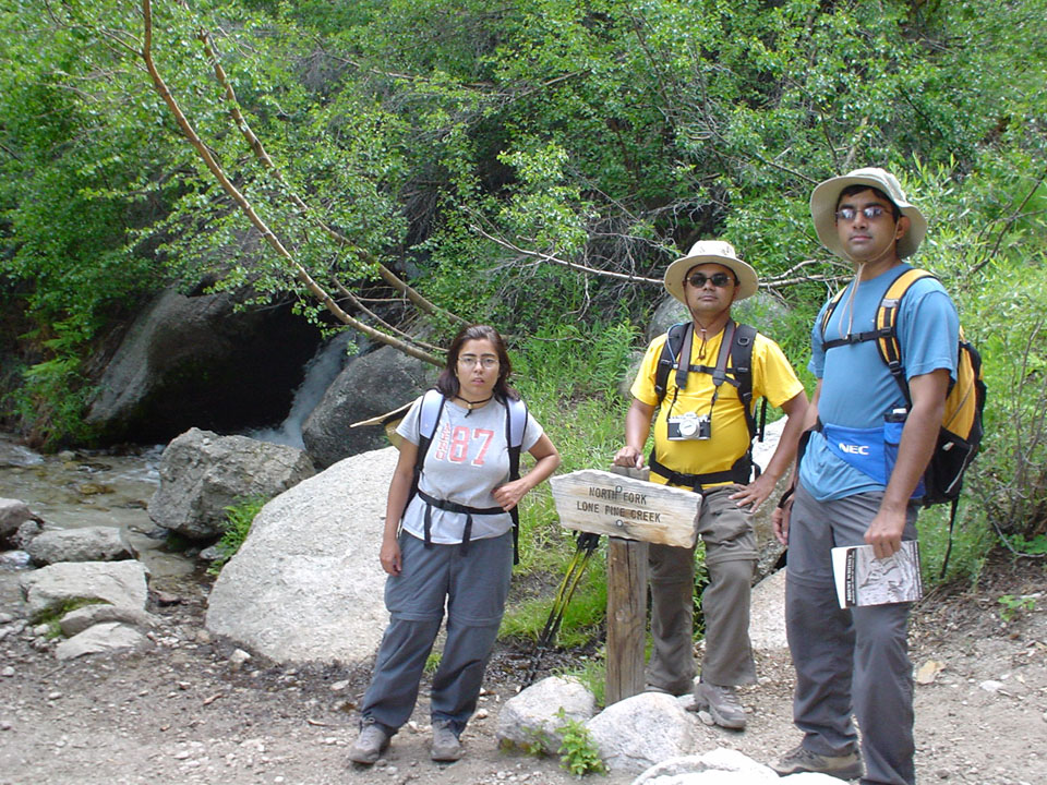
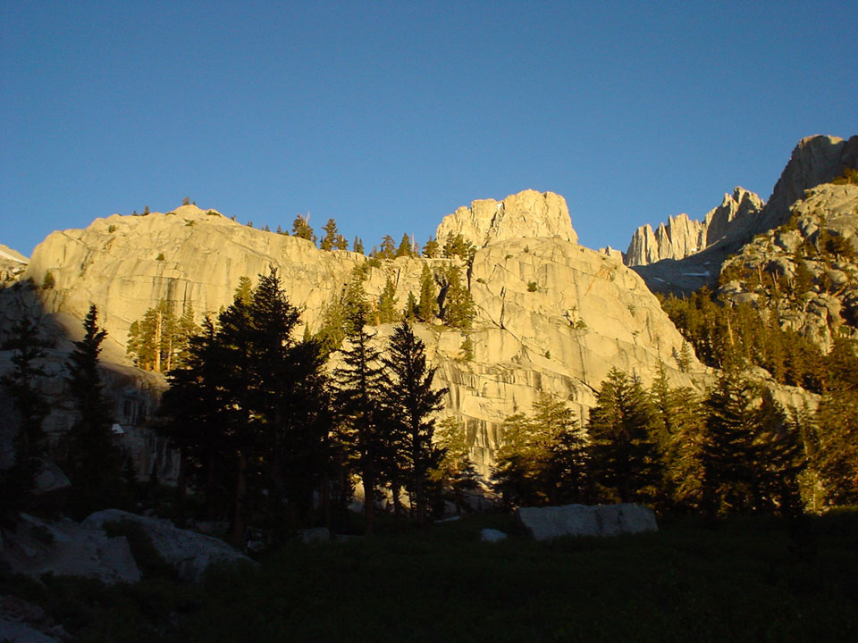
Best Western in Lancaster has an excellent restaurant attached, and we start the day paying a good deal of respect to it. Happy and fed, we roll the top down in our awesome Mustang convertible, that looks more like a cheap Lego set with the worst V6 in the world than anything else, and sips gas at a mere 15 mpg. Takes about 2.5 hours to reach Whitney Portal. By then everyone else in the team had already started the practice hike, and we get going with as little delay as possible. Adventurous that we are, we decide to try out the MR trail, since we'll have to do the Main Trail the next day anyway. About an hour into the hike, we meet up with the rest of the gang, making their way down. Krishna switches sides and comes over to do the MR again with us. I've always insisted that guy is built more like an ox. Mistakes are made and corrected, cramps are felt and lost, water is consumed at hydration procedure levels, and we make it to the "Ebersbacher Ledges". With really optimistic plans of starting the trail the next day at 3 in the morning, we decide it was time to head back.
|
|
|
|
|
|
|
|
|

|
|
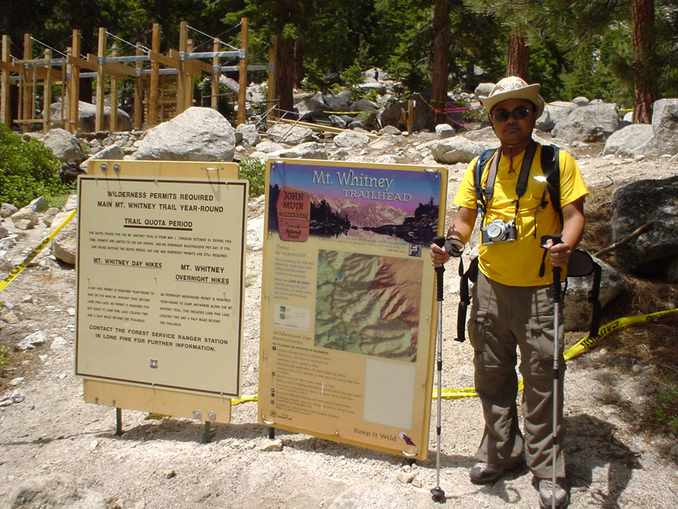
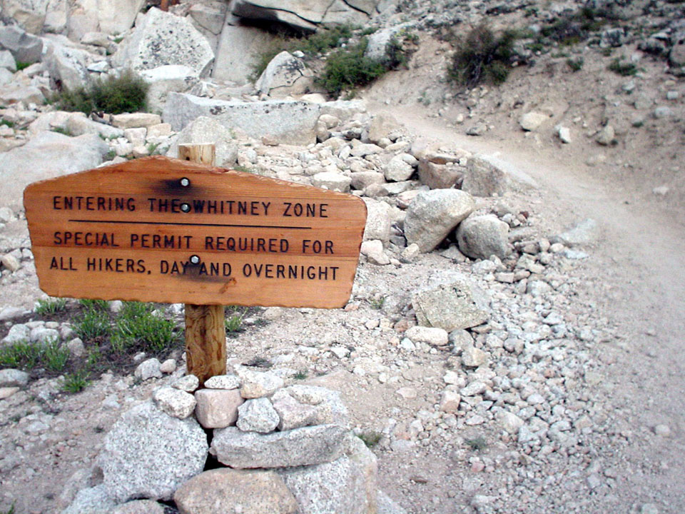
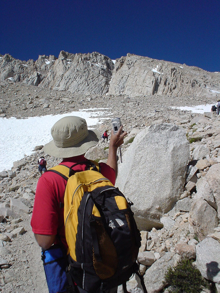
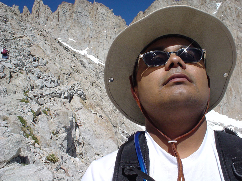
Wake-up is at a healthy 1:30am (!). The Mustang is abandoned in favor of other healthy cars, and the trailhead at Whitney Portal is reached shortly before 3. The campers in the group - Mainak, Manohar, Soumya, Souvik - had started on their own. Group shots follow at the trailhead, and we start off at 3:10. A few steps into the trail, I realize I was carrying the heavy Nikon SLR with only 6 shots left, and no extra film, so I make a quick trip to the trunk of Krishna's car to get rid of it. Which means all you see here was captured through a 4oz Sony mini digital camera that looks more like a cigarette lighter than anything else.
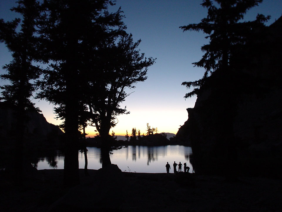
LEDs show us the way - and a few disturbed deer - as we make our way up the main trail, crossing streams and jumping rocks exactly like John Muir did many many years ago. Up until Lone Pine Lake, there's nothing to see, as it's still dark out. Stops are minimal, energy levels are still high. Little do we realize that we won't be seeing these parts of the hike at all, as it'll be dark again by the time we reach this point on our way back.
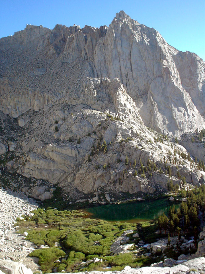
Someone should have mentioned that the Lone Pine Lake is a good half mile (round trip) detour from the main trail. With all the water available on the main trail, we could easily have skipped the extra effort. But then we would have missed out on these pics of the lake.

|
|

|
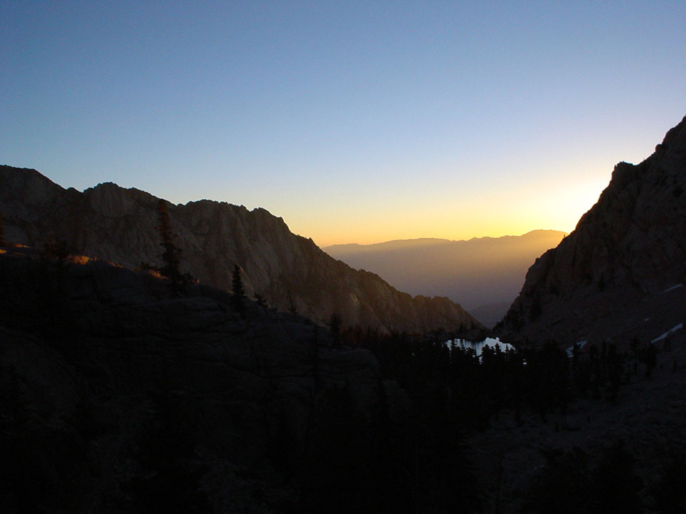
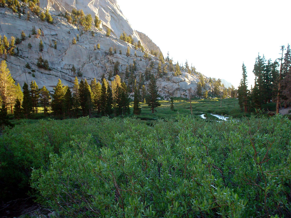
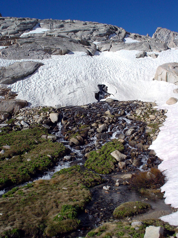
The sky starts getting brighter, and we hike through a brilliant sunrise before we start descending into the greenery of the Bighorn Sheep Meadows. As the day gets brighter, so do our energy levels. The hike here is, even for newbies like us, pretty easy and relaxing. In fact, the downward hike in this area was quoted as the "dreaded upslope" in the return journey. There's a really nice part here where we had to cross a stream by balancing on logs - 11 of them in fact, end to end - that looked really pretty and "out in the wilderness".
|
|
|
|
|

|
|
|
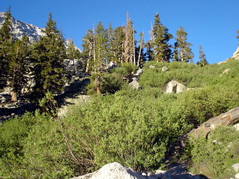
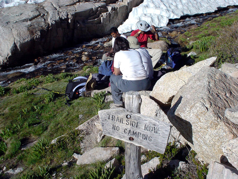
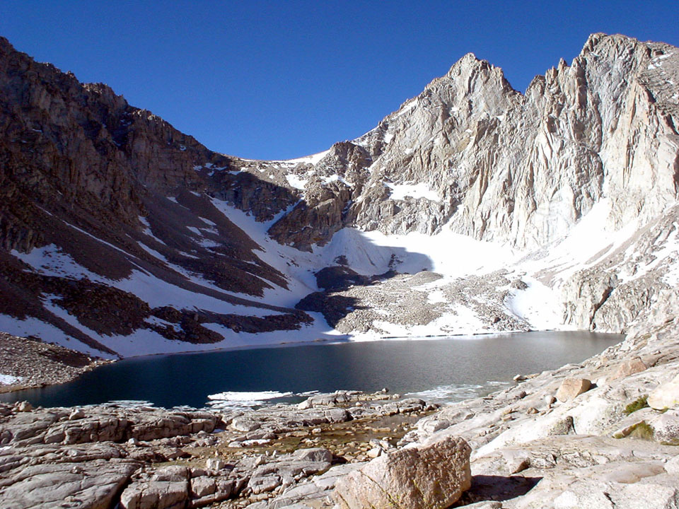
Here's where the altitude factor starts kicking in. We had already been hiking for a few hours by now, and muscles were starting to get tired. Soon after mirror lake, we hit the first decent upslope above 10k feet - Ranjita slowed down at this point and decided to take a break. Kanishka, the maniac, did the slope 3 times, in order to figure out if Ranjita could manage the hike up, and slept for 20 minutes. By then, the rest of us were far ahead. Then he decided to catch up with us, and put his turbo boosters on. The rest of us reached Trailside Meadows and waited for about half an hour before proceeding to the trail camp. We had hardly reached the trail camp, and were looking for the "last water supply", when Kanishka caught up with us.
|
|
|
|
|
|

|
|
|
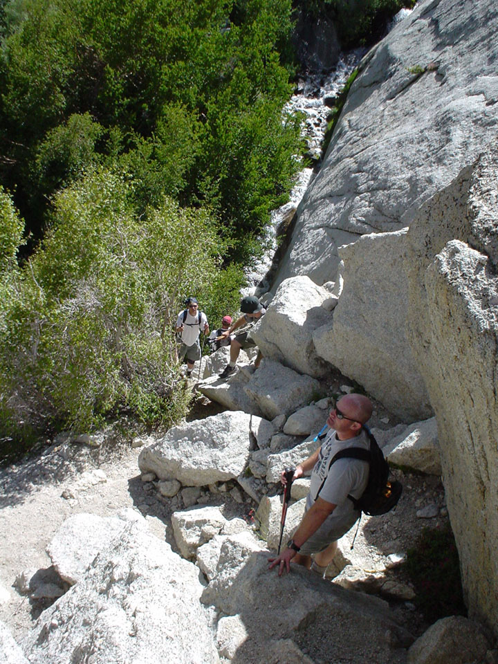
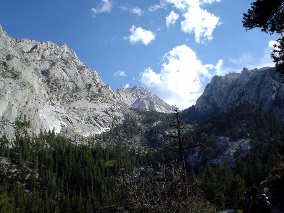
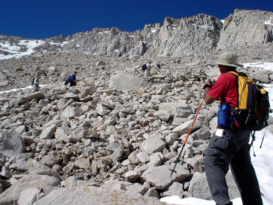
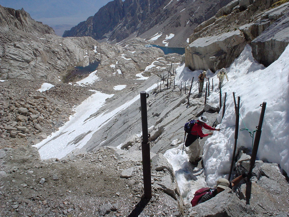
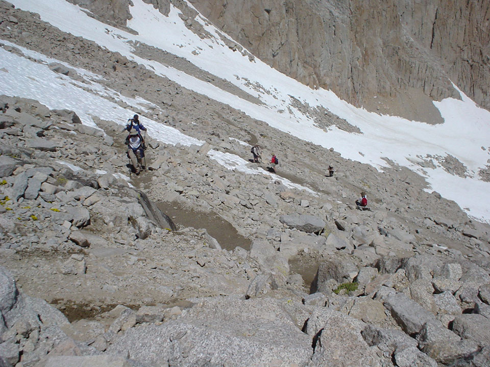
A few points here, before I go into the agony of the switchbacks. The "last available water source" is not the trail camp - at least, not when we were hiking. Had we known that information, I for sure would not have filled in my water reservoir with the worst possible water on the trail - the stagnant supply of the lake at trail camp, which looks even more pathetic as you make your way up the switchbacks. There were a lot of tiny streams that we crossed for the first third of the switchbacks - and all of them looked cleaner and more refreshing than the lake water. But then, if you are reading this before your hike, these streams are very seasonal - the water had increased several times by the time we were hiking back - so it's best not to depend on them. On the positive side, we noticed some people had done away with their extra luggage - sweatshirts and stuff - and placed them by the side of the trail with a rock as the security officer. Kanishka got rid of his sweatshirt, and I got out a little more - caps and some other junk I was carrying along.
|
|

|
|
|
From what I felt, the switchbacks are not difficult by themselves. Long as hell - yes, but if you move the area to under 8000 ft, then I'm sure no one would be complaining about them. Now, in reality, they happened to be much, much higher up - so I had to stop for a few seconds after tackling every couple of them. It was nice to play tag with other people - Pani and I did this for a while - he would go 2 switchbacks and stop to take a breather, when I would start and reach him. At that point, I would be out of breath, and would stop, and he would go ahead a couple more. That way, we even managed to maintain a steady pace!
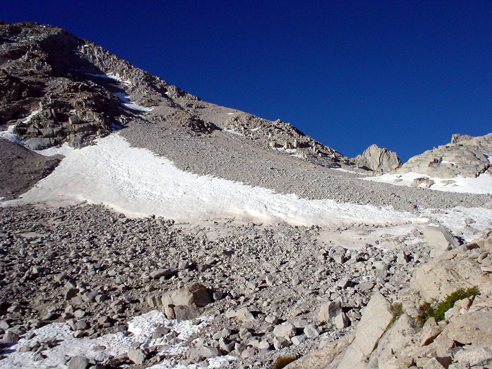
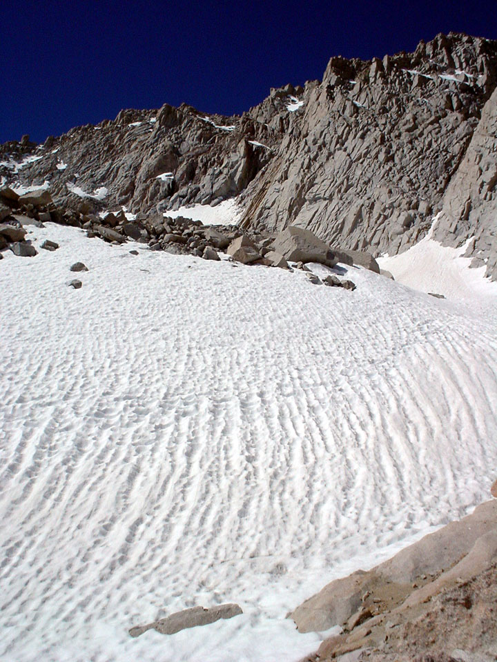
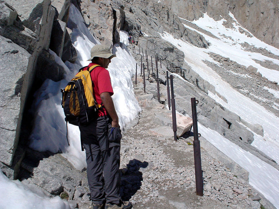
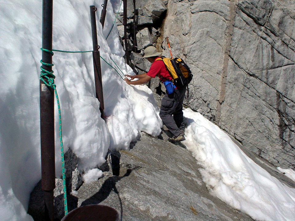
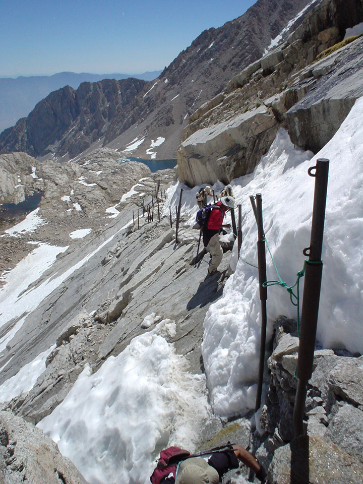
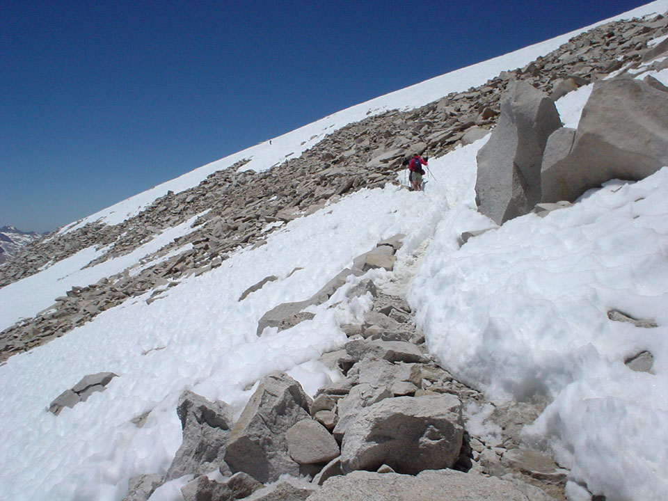
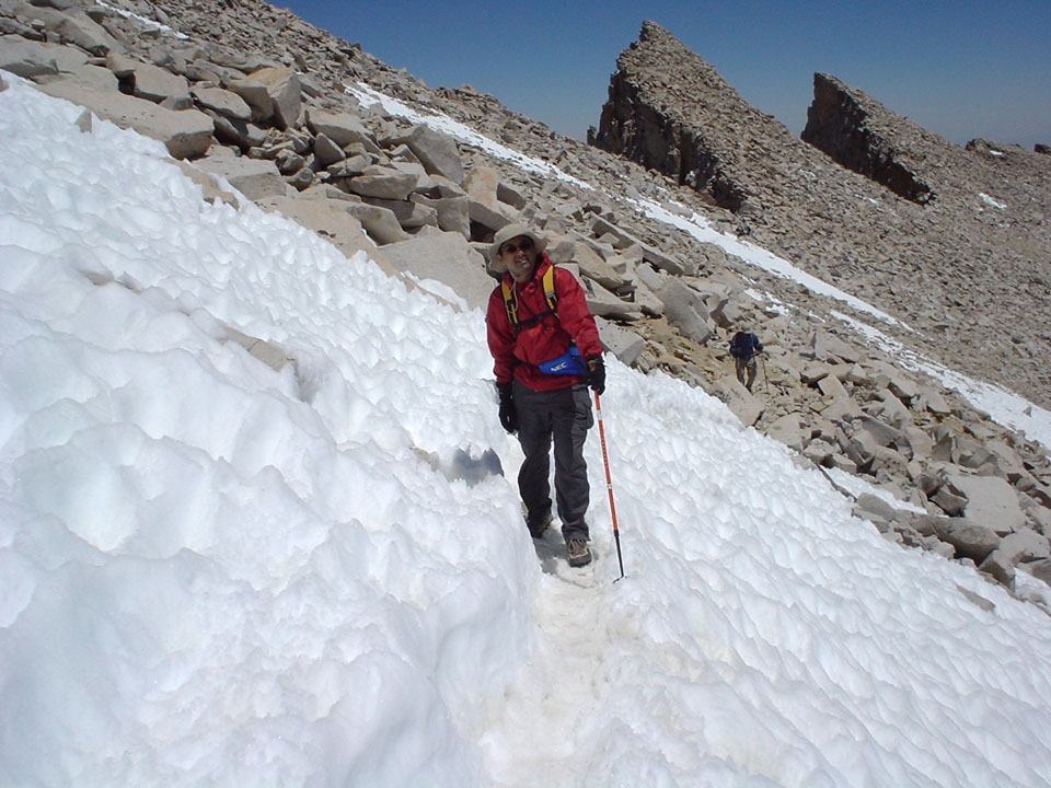
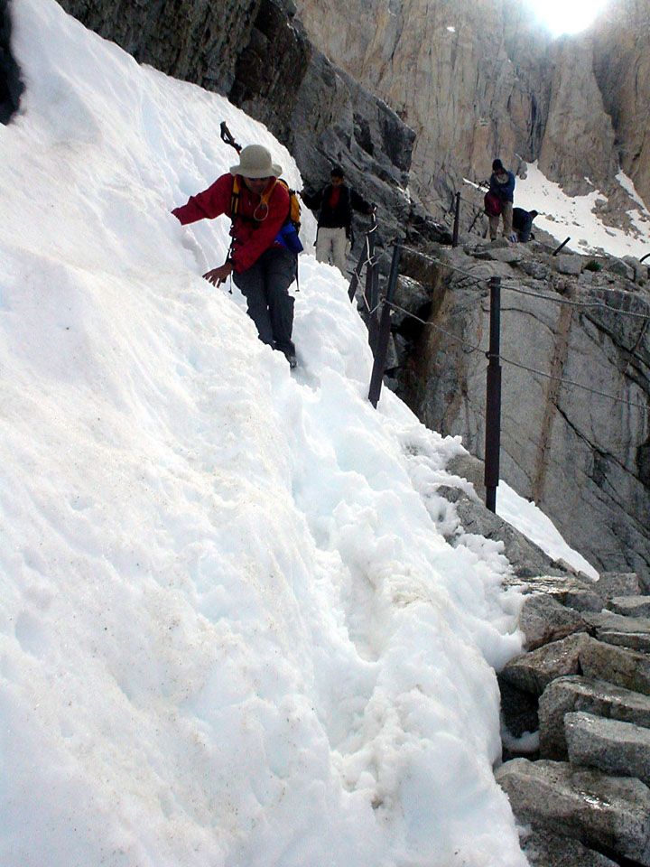
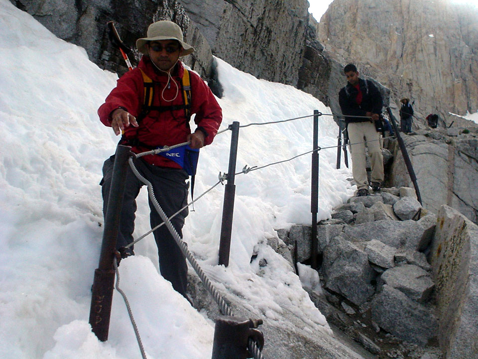
As far as challenging parts of the hike are concerned, this part took the cake - with the short stretch of 50ft or so where the cables were set up. Except that the cables were down when we were going up. Instead of the cables, we had to swing ourselves by holding a nylon rope, and make a dangerous crossover across some very slippery ice. However, that was short and sweet, compared to the rest of the trail. We came across a few more sections that were snow covered, and had to resort to making a few shortcuts in the switchbacks in order to guarantee a one-piece return. For those who are preparing for the hike, I have 2 words of safety - "trekking poles".
|
|
|
|

|
|
|

|
|
|
|
|
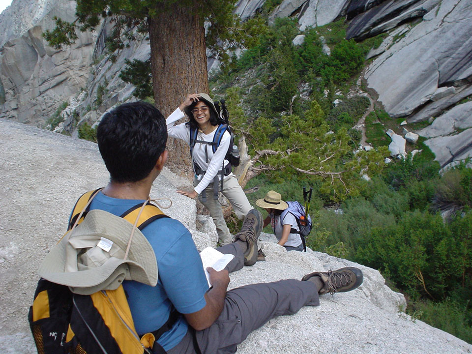
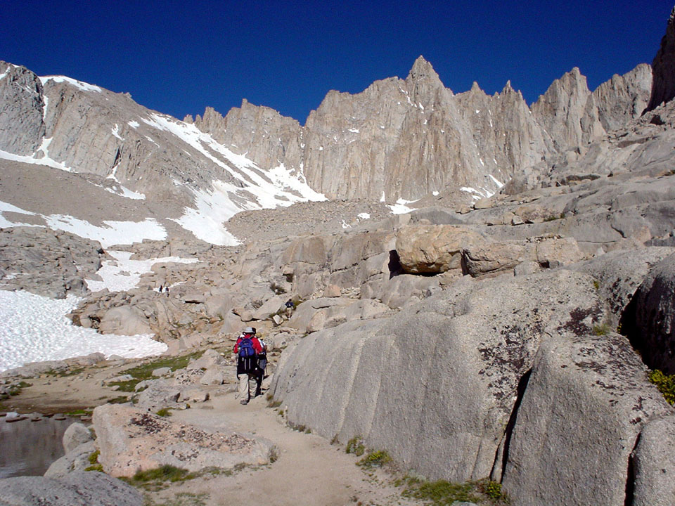
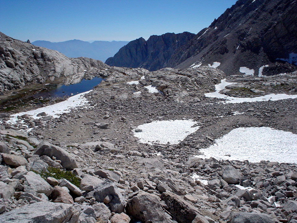
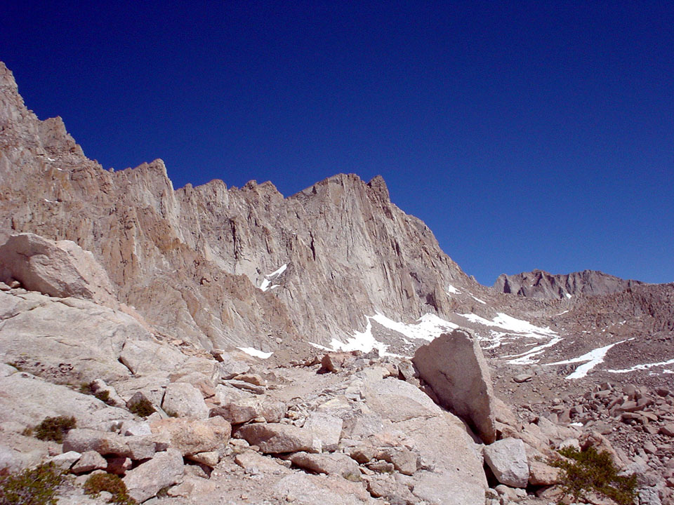
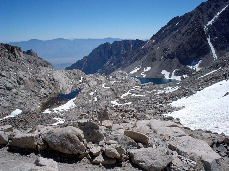
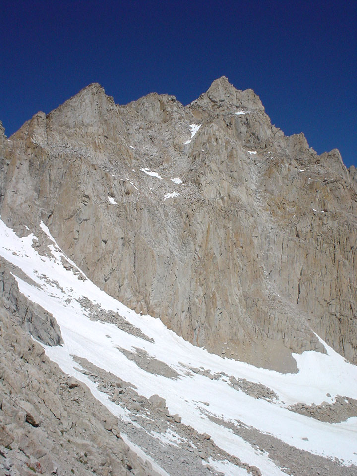
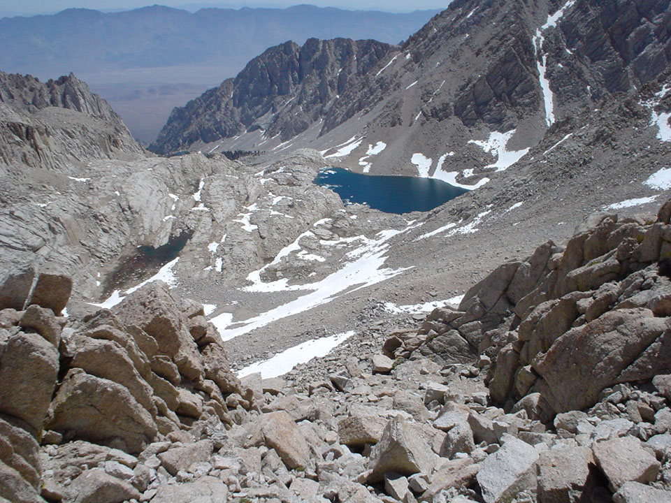
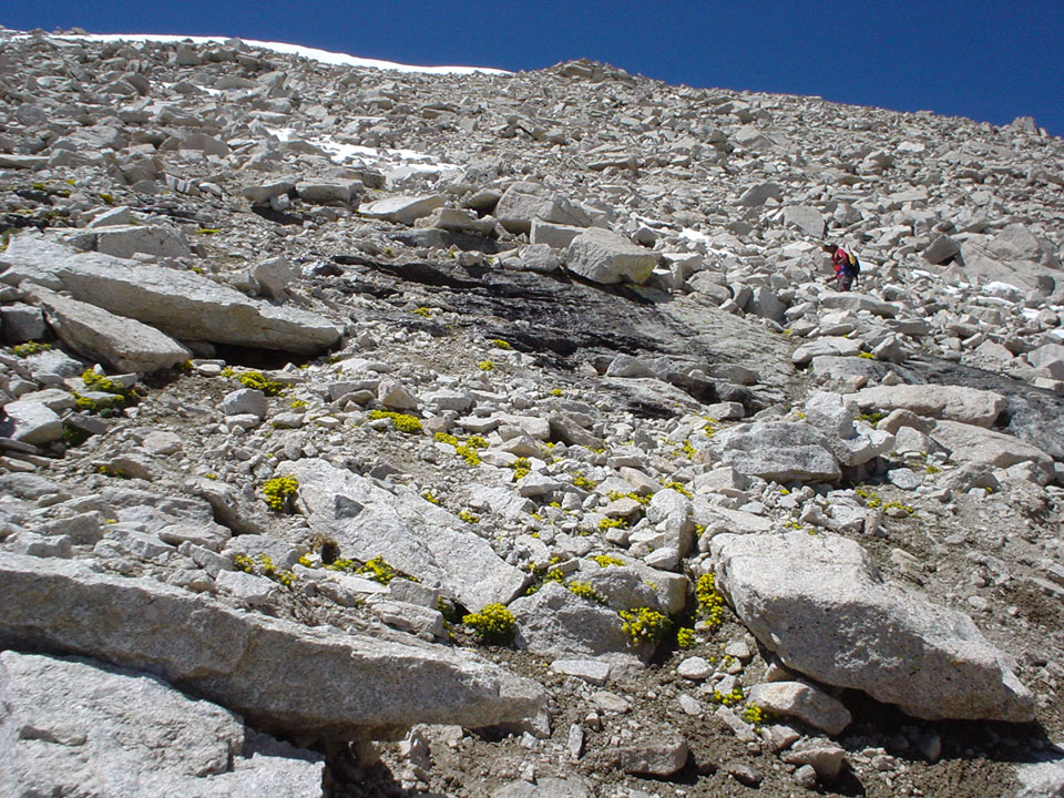
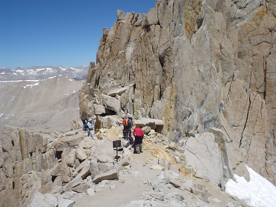
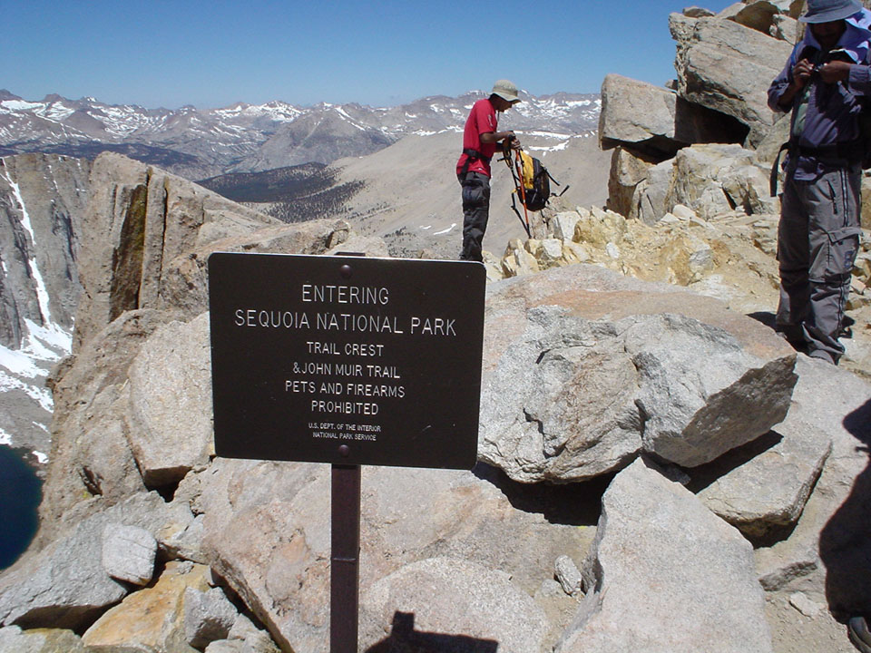
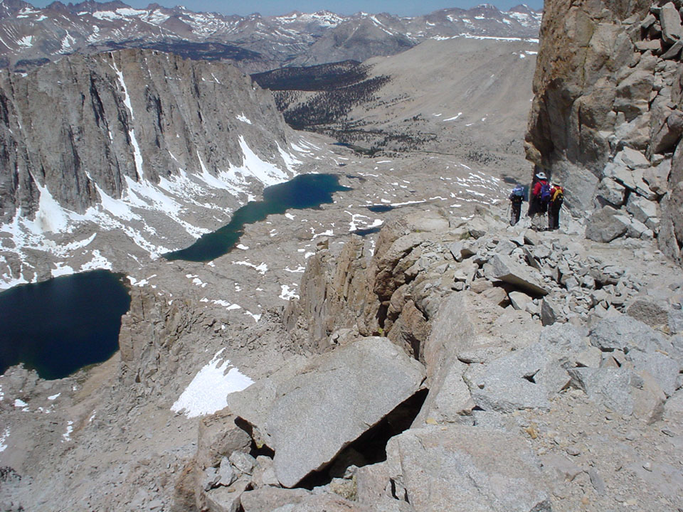
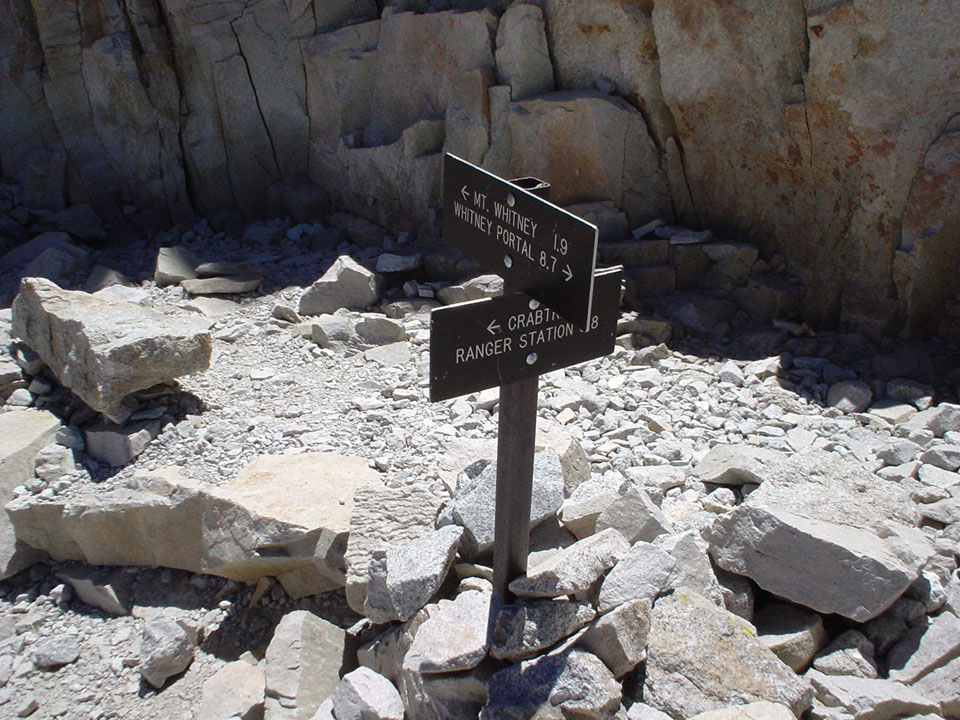
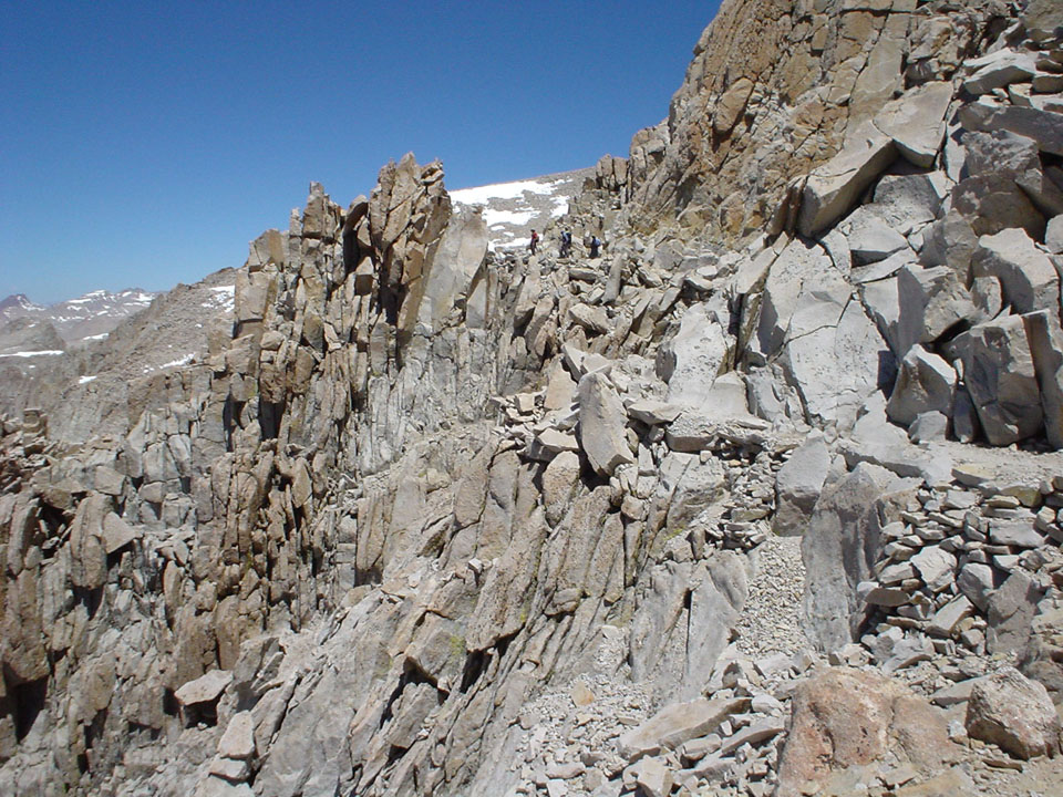
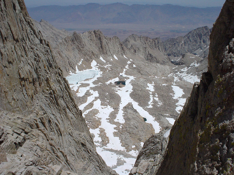
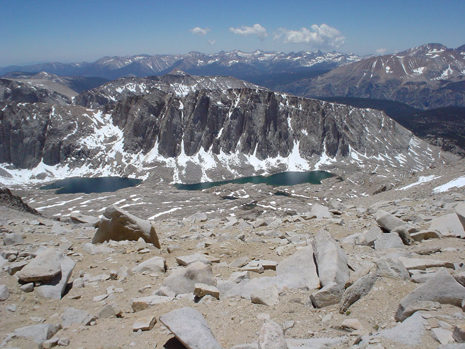
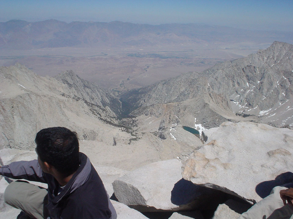
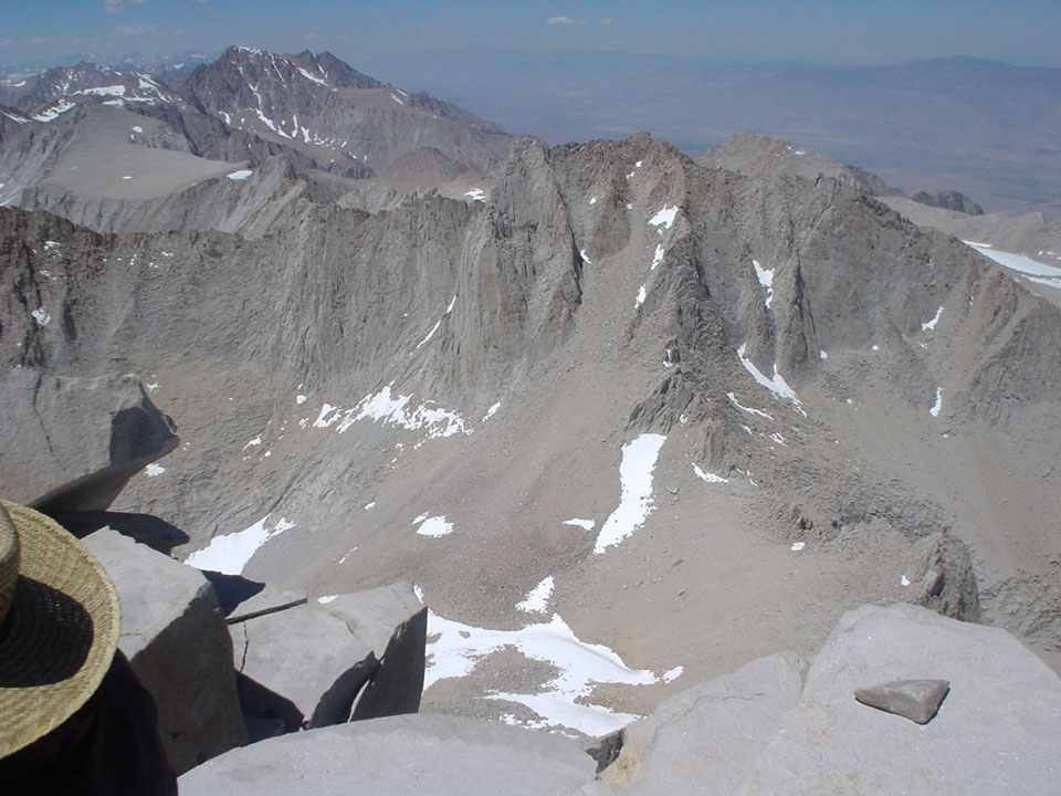
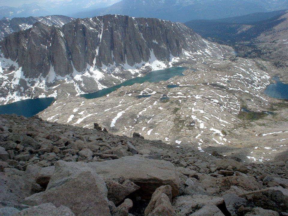
After about a million switchbacks (people say 96, Scaruffi says it's more like 140), we reached the Trail Crest - with the sign saying we were officially entering the Sequoia National Park. As soon as we crossed over to the other side of the mountain, the view changed dramatically - and we basked in the wonderful views of the Hitchcock Lakes and the Guitar Lake. We also took note of a little fork in the road, and made sure we went the way to Whitney Summit, and not the John Muir trail to oblivion and beyond. Somewhere along this point, Mainak and Souvik decided to turn back - at a bare mile or so from the summit. Unfortunately, this part of the hike stays in my memory as the toughest bit - none of the trip reports we had read mentioned how far the summit looked from the trail, and how long the trail really was. All we had read mentioned that once the trail crest was over, we were practically at the summit - and that was as far away from the truth as anything can ever be. When we were expecting another 20 minutes of hike, the encouraging estimate of people hiking down was more like an hour - which meant a good hour and a half for people like me. Moreover, the sun was shining bright over all the expanses of snow - even with the sunglasses, it was easy to feel the glare, and I finally understood why people complain about snow blindness in the Whitney hike even though they come from the east coast, where it snows throughout the winter. Never had to face the shine of the summer sun on vast expanses of snow before.
|
|
|
|
|
|

|
|
|
|
|
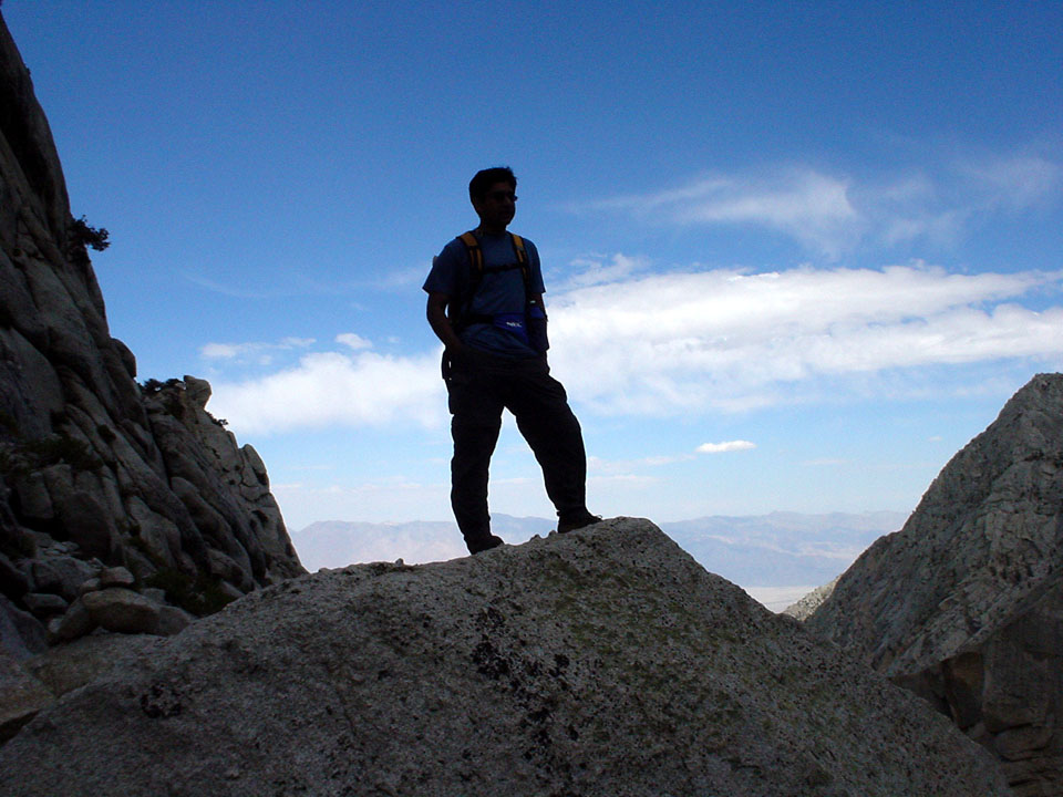
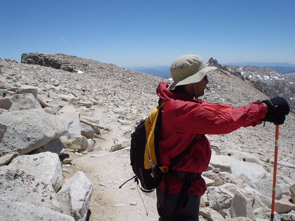
After another million miles or so, with a lot of height being gained and lost, we were on the final stretch of the hike just before 2pm. Kanishka decided to maintain a steady pace with no breaks. I decided to go for slow pace with lots of breaks, in order to compensate for his break time as well. Now that the summit was in clear view, there was no way I was turning back - but then at 14k ft above sea level, I am not a jogger. Come to think of it, I can't even jog at sea level.
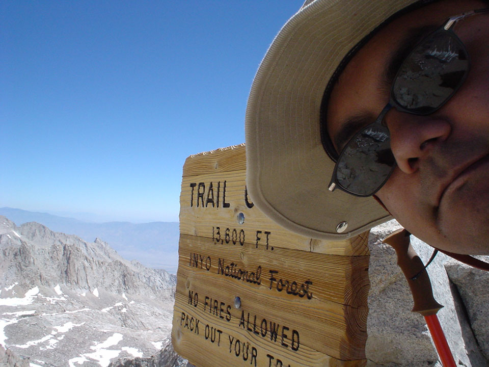
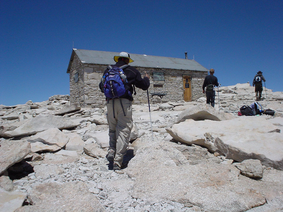
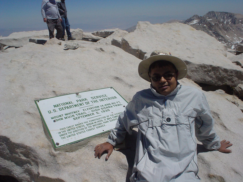
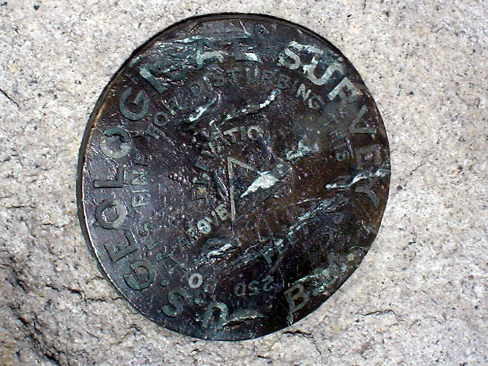
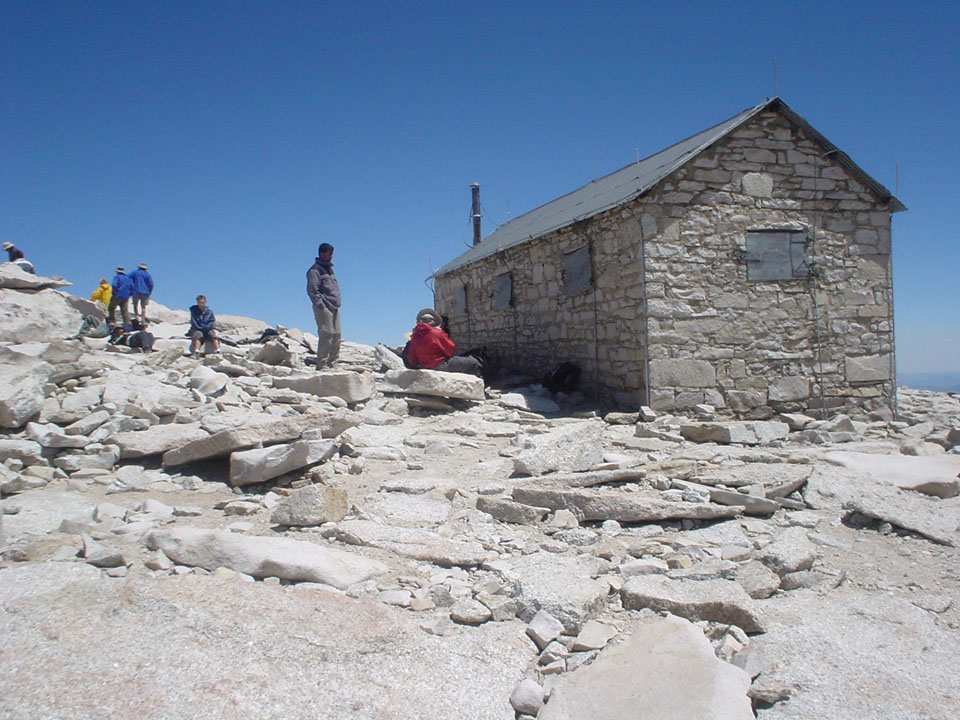
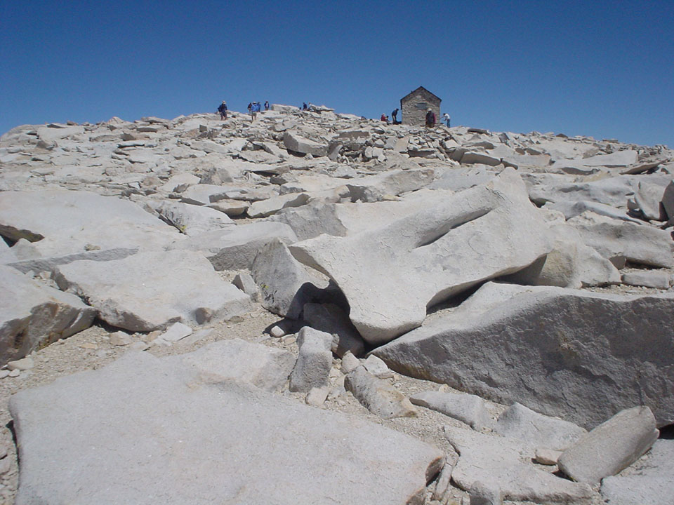
Around half past 2, the unthinkable happened - I reached the summit. Krishna, Snigdha, Kanishka were there already. Pani and Mahim came up at the same time as me. It was time to take a lot of photographs, and bask in the glory, keeping the little thought about the hike back in the distance. We had carried some sandwiches for lunch - mine tasted exactly like sugarfree, tasteless chewing gum coated with plain oatmeal. Contrary to my imagination, the summit is a vast area, as big as a soccer field. Too bad the idea of taking a football up the mountain did not work out - purely for lack of volunteers to carry the tiny load.
|
|
|
|
|
|

|
|

|
Around 3, we decided we were done with lunch and happy phone calls to near and dear ones (yes, Verizon works like a charm up there - but remember to switch the phone off through the hike, or your battery will give you a few seconds of talk time). It was time to get up on our sore feet and head back. Easier said than done. We had expected the way back to be much faster - well, it was, compared to our rate of going up, but it was still pathetic compared to the average return time of 7 hours. The hike to trail crest was positively irritating, with all the little upslopes - and that got worse when we missed the trail and ended up doing a little class-3 hiking before getting back on the track. Some people were glissading down from the beginning from the switchbacks - we looked at them and thought, they must know something we don't, and decided to go back the way we came. Thankfully, the cables were up now in the short dangerous part, and crossing it involved less acrobatics, and more digging into the snow. Oh yes - with the cables up, and the snow still there, we were pratically above the cables, so we had to do little glissades to make it across :)

|
|
|
|
The best part of the hike down was the switchbacks. The trail is soft an solid, and we all made good time. Towards the end, we found the little streams had increased tenfold in volume, and were now following the trail for several switchbacks at a time. Some care had to be taken not to get shoes wet, specially since I was wearing trail running shoes made of cloth uppers. We took a break at trail camp, and one at mirror lake, and then just paid a lot of attention to placing one foot before the other. Once it got dark, morale reached an all-time low in this hike, conversations grew scarce, and nerves were a little shot. Unfortunately, as mentioned before, we could never see what the first few miles of the hike were like, since we were in the dark in both directions. The sign at Lone Pine Lake saying 2.5 miles to trailhead was accepted with good cheer, and we expected to make it down in a short while. Little did we know about this story that claims it's more like a fairy tale. The last 2.5 miles were the worst - they got to us all. Every turn we would take, people would eagerly look out for the river, which meant the fork, and civilization close by. Lights seen from the ground far below looked as far as eternity. One foot before the other for a good 2.5 hours finally brought us to the trailhead with just about an hour left in the day. And that was that.
Created on ... June 21, 2004
Special thanks to Bill, Leigh ond Celeste for the trip report breakdown