|
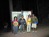
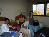
Hotel, Phoenix, Arizona. Whatever. Beginning of the trip.
|
|
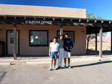
US Post Office, Marble Canyon, AZ 86036: where we stopped for a break in the 5+ hour shuttle ride from the south rim to the north
|
|
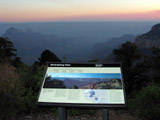
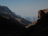
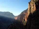
Viewpoint, North Rim. Our only view of the north rim was in this late afternoon light, barely minutes before sunset
|
|
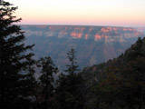
Sunset, north rim.
|
|
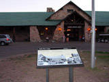
North Rim Lodge. They had some cool T'shirts, but then I didn't like the idea of hauling the goodies across the entire canyon bed the next day
|
|
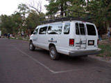
Kraftwerk's Trans Europe Express. The Trans Canyon Shuttle that brought us from the South Rim to the North, at $60 per head, plus free nonsetop entertainment from the driver, of which I do not remember a word
|
|
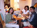
Grand Canyon, Moritury Te Salutant "We who are about to die salute you". Well, more like "Screwed te salutant". Making packed lunches for the road
|
|
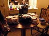
Armed with ziplock sandwich bags (quick seal!), ham, salami, cheese, butter, jam, a ton of white bread (sucks!), cucumbers, tomatoes, and the like, we set out to conquer the Grand Canyon
|
|
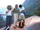
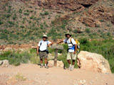
Behold! The great adventurers pose before the trailhead for the North Kaibab Trail. When asked "How long do you think you'll take to cross", we reply "no idea". 5:15am, North Rim.
|
|
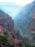
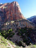
About 6 miles down the hike. See that faint horizontal like about 2/3rd to the top? That's the South Rim, where we are headed. "To the Land of Mordor where the shadows lie"
|
|
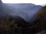
Misty early morning light. The first rim - in the dark - is the inner canyon. The one far far away - visible in top right, in the light - is probably the south rim
|
|
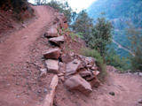
Switchbacks. We had to cross several millions of these to get across. Yes, I double checked my count.
|
|
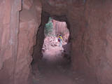
Supai Tunnel. Or whatever. Nothing very impressive. Just before the first bridge, I think.
|
|
|
|
|
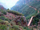
About 5 miles down the trail, we reach our first bridge (seen far below). As per hike guidelines, should take about 20 mins to reach that bridge. I think we made it in time.
|
|
Almost there. The first bridge around the corner. We cross over from Kaibab Limestoke to the Hermit Shale, I think. Please correct me if I am wrong, though I could not care less.
|
|
We reached it! The first bridge. Enthu levels are still high, hence this high density of photographs.
|
|
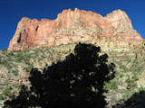
First light from the sun falls on these peaks on the border of the inner canyon
|
|
|
|
|
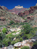
Cocono overlook, or the Roaring Rapids.
|
|
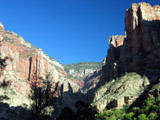
Looking back from the Roaring Rapids, with the Kaibab layers above us. Few miles into the hike. Still in the inner canyon.
|
|
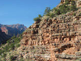
Definitely into the Hermit Shale layer now. Across the first bridge.
|
|
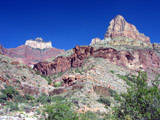
Hiking below the Peak of the Three Kings. Sorry - I made that up. No idea what this is called.
|
|
Now, that peak in the background - that has to be something famous. Will have to find out what it's called. They should give us zero weight audio guides in the hike
|
|
|
|
|
Same peak as above. If you know the name, why are you smiling instead of telling it to me?
|
|
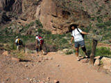
Have we reached the Box Canyon yet? Pretty much there, I think. About 5 miles of shadowless sun awaits us
|
|
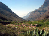
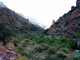
Somewhere between the north and sounth rims. Looking at the greenery and the shadows, probably before entering the box.
|
|
The fork - choose the 2 mile detour to the Ribbon Falls, or straight ahead to the regular trail (or back to Cottonwood Campground)
|
|
The choice is made, and we set off for the Falls.
|
|
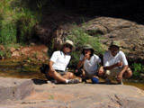
Been There Done That, visiting Ribbon Falls, a 2 mile detour from the trek- unless you use your brains and go along 2 sides of the triangle, instead of back and forth the same way
|
|
|
|
|
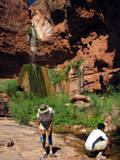
Ribbon Falls was a nice, cool relief from the scorching sun of the Box Canyon, to come soon after
|
|
|
|
|
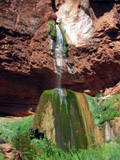
Ribbon Falls.
|
|
|
|
|
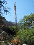
Funny looking plant between Ribbon Falls and Phantom Lodge
|
|
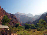
Looking up from the Phantom Ranch. The shop sells cold beer, lemonade, and food. Temperatures are nearing a hundred in the shade. Next time, just make a reservation here and split the hike to a few days
|
|
From the middle of the Silver Suspension Bridge, looking at the Black Bridge. There was some funda about the bridge written on one of the posts, but I have forgotten every bit of it now
|
|
River bed. Nice and cool winds. Walking in the shadows, mostly on soft wand beds.
|
|
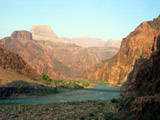
View at both the bridges - black and silver. We came down the black and went up the silver. No wait - we didn't use the black at all this time
|
|
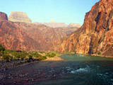
The mother of all exposed rock layers - the Vishnu Schist, below the Zoroaster Granite. Looked like another rock to me, but apparently this is very impressive.
|
|
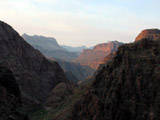
Sunset, on our way up. See everything you can see? We walked all that. Everything.
|
|
|
|
|
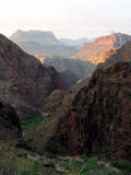
Is this sunrise or sunset? Don't really know.
|
|
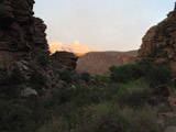
Don't know this one either. Looks like sunset.
|
|
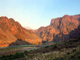
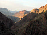
This is definitely sunset. Peaks closer to the south rim are in view. The one in the distance is the prominent peak from the south rim.
|
|
The day after. Just had some food go into our system. We missed the previous day's dinner - after the 17.5 hour hike - because we were about an hour too late.
|
|
|
|
|
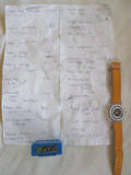
Complicated navigation and logging instruments that were used to record the progress of the hike. Surprisingly, the stupid manual pedometer gave a pretty good estimate
|